
Living in a bustling metropolis brings excitement and opportunity, but it also comes with unique challenges when disaster strikes. Modern technology now offers powerful tools to help urban residents stay informed and prepared.
🌆 Understanding the Urban Disaster Landscape
Cities are complex ecosystems where millions of people live, work, and move through interconnected spaces daily. This density creates specific vulnerabilities when emergencies occur. From natural disasters like earthquakes and floods to human-made crises such as industrial accidents or terrorist attacks, urban environments require sophisticated monitoring systems to keep residents safe.
The concentration of population, infrastructure, and resources in cities means that disasters can escalate quickly. A broken water main becomes a neighborhood crisis. A chemical spill affects thousands within minutes. A severe weather event can paralyze transportation networks, leaving people stranded. Understanding these unique urban challenges is the first step toward effective disaster preparedness.
Modern cities face an expanding array of potential threats. Climate change has intensified weather patterns, bringing unprecedented rainfall, heat waves, and storms to urban areas. Aging infrastructure in many cities creates additional vulnerabilities. Meanwhile, the complexity of urban systems means that failures in one area can cascade into multiple sectors, affecting power, water, communications, and transportation simultaneously.
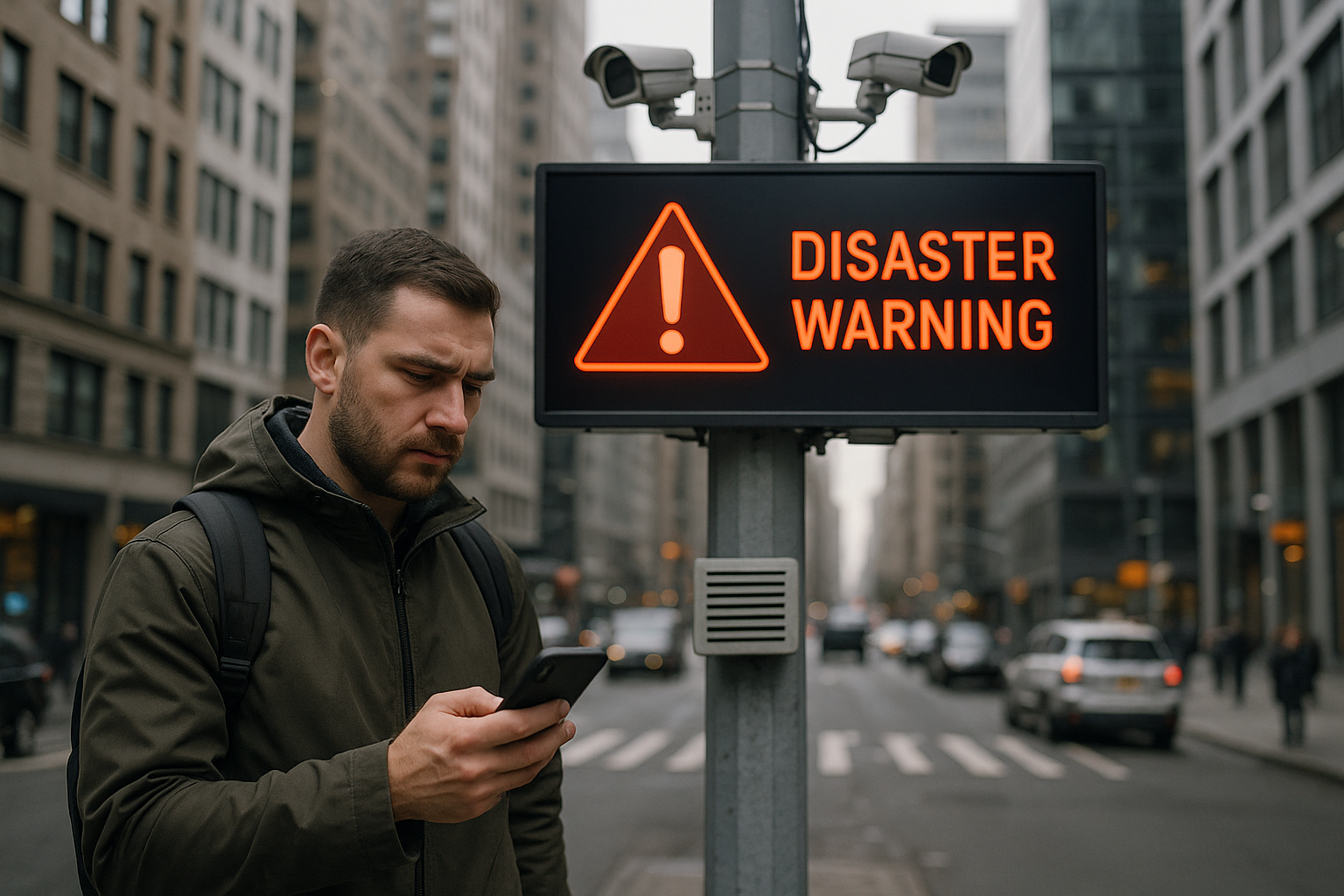
📡 How Urban Warning Systems Work Behind the Scenes
Urban disaster warning systems represent a sophisticated network of sensors, communication channels, and data processing capabilities. These systems continuously monitor environmental conditions, infrastructure status, and potential threats to provide timely alerts to residents and emergency responders.
At the core of these systems are detection mechanisms. Seismometers track ground movements to detect earthquakes. Weather stations monitor atmospheric conditions for severe storms. Water level sensors watch rivers and drainage systems for flooding risks. Air quality monitors detect hazardous pollution or chemical releases. Traffic cameras and sensors track evacuation routes and emergency vehicle access.
Data from these sensors flows into command centers where advanced algorithms analyze patterns and identify potential threats. When systems detect conditions that meet alert thresholds, they trigger notifications through multiple channels. This redundancy ensures that messages reach people even if some communication networks fail during an emergency.
Integration Across Multiple Platforms
Modern warning systems don’t rely on a single communication method. They integrate multiple platforms to maximize reach and effectiveness. Emergency broadcasts go out simultaneously through television, radio, mobile phone alerts, social media, outdoor sirens, digital billboards, and specialized emergency apps.
This multi-channel approach acknowledges that people consume information differently. Some may have their phones on silent but see a television alert. Others might miss a text message but hear an outdoor warning siren. By delivering information through numerous channels, systems increase the likelihood that everyone receives critical warnings.
📱 Essential Mobile Apps for Urban Safety
Your smartphone can be a lifeline during urban emergencies. Several applications provide real-time disaster warnings, safety information, and communication tools specifically designed for crisis situations.
Emergency Alert Applications
The Federal Emergency Management Agency (FEMA) app delivers weather alerts, emergency safety tips, and disaster resources directly to your phone. It provides real-time notifications for up to five locations, making it ideal for monitoring your home, workplace, and family members’ areas.
The American Red Cross offers several specialized apps, including Emergency, Earthquake, Hurricane, Tornado, and Flood apps. These applications provide location-based alerts, preparedness information, and tools like flashlights and alarms that work even without cell service or internet connectivity.
Weather and Environmental Monitoring
Weather apps have evolved beyond basic forecasts to provide severe weather warnings and real-time tracking of dangerous conditions. Many include radar imagery, lightning detection, and minute-by-minute precipitation forecasts that help you make informed decisions about outdoor activities or commute routes.
Air quality monitoring apps have become increasingly important for urban residents, particularly in cities prone to wildfires, industrial pollution, or high traffic emissions. These apps provide real-time air quality index readings and health recommendations, helping sensitive individuals protect themselves during hazardous conditions.
🚨 Understanding Different Types of Urban Alerts
Not all emergency alerts carry the same urgency or require the same response. Understanding different alert types helps you react appropriately and avoid both complacency and panic.
Wireless Emergency Alerts (WEA)
These are the alerts that cause your phone to emit a distinctive tone and vibration pattern, even when your device is on silent. WEA messages come from authorized government agencies and cover three main categories: presidential alerts (national emergencies), imminent threat alerts (immediate danger to life or property), and AMBER alerts (child abduction emergencies).
WEA alerts are geographically targeted, meaning they only reach devices in affected areas. The messages are brief, typically 90-360 characters, and provide essential information about the threat and recommended actions. You cannot opt out of presidential alerts, but you can disable AMBER alerts and imminent threat alerts in your phone settings, though this is generally not recommended.
Local Emergency Notification Systems
Many cities operate their own emergency notification systems that residents can subscribe to. These systems typically offer more detailed information than WEA and may include non-life-threatening information like boil water notices, planned emergency drills, or community safety updates.
Registration for these systems usually requires providing contact information and specifying your preferred notification methods. Some systems allow you to designate multiple addresses, such as home and work locations, to receive location-specific alerts.
🏗️ Infrastructure Monitoring Systems Protecting Your City
Behind the scenes, cities employ sophisticated infrastructure monitoring systems that work continuously to prevent disasters and provide early warnings when problems emerge.
Structural Health Monitoring
Major infrastructure like bridges, tunnels, and large buildings increasingly incorporate sensors that continuously monitor structural integrity. These systems detect subtle changes in stress, vibration, or displacement that might indicate developing problems. When sensors detect concerning patterns, they alert engineers who can investigate and address issues before they become emergencies.
Following earthquakes or other significant events, these monitoring systems help engineers quickly assess structural damage and determine whether buildings are safe for occupancy. This rapid assessment capability can save lives by preventing people from entering compromised structures.
Water and Flood Management
Urban flooding poses a significant threat to cities worldwide, and monitoring systems have become increasingly sophisticated. Networks of rain gauges, stream sensors, and drainage system monitors track water levels in real-time. Advanced modeling predicts how rainfall will affect different neighborhoods based on topography, drainage capacity, and soil saturation.
These systems enable authorities to issue flood warnings hours before water arrives, giving residents time to move vehicles, protect property, and evacuate if necessary. Some cities have implemented smart drainage systems that automatically adjust to changing conditions, redirecting water flow to prevent overwhelmed areas from flooding.
🔔 Making the Most of Warning Systems
Having access to warning systems is only valuable if you know how to use them effectively and respond appropriately when alerts arrive.
Preparation Steps for Urban Residents
Enable emergency alerts on your mobile devices by checking your phone settings. On most smartphones, you’ll find emergency alert settings under the notification or security sections. Ensure that government alerts and emergency broadcasts are enabled.
Register for your city’s local emergency notification system. Visit your city government website to find registration information. Provide multiple contact methods including phone numbers, email addresses, and text messaging preferences to ensure you receive alerts through various channels.
Identify your community’s outdoor warning systems. Learn what different siren patterns mean in your area. Some cities use different tones for different threats or severity levels. Understanding these distinctions helps you respond appropriately.
Creating Your Personal Alert Strategy
Develop a communication plan with family members that includes designated meeting places and out-of-area contacts. During major disasters, local phone lines often become overloaded, but text messages and calls to distant areas may still work. Having an out-of-town relative or friend as a central contact point helps family members stay connected.
Maintain a list of important local information sources including local emergency management social media accounts, radio stations that broadcast emergency information, and community websites. During widespread emergencies, these sources often provide neighborhood-specific information that national systems cannot deliver.
🌐 Social Media and Crowdsourced Disaster Information
Social media has transformed how information spreads during emergencies, creating both opportunities and challenges for urban residents seeking reliable information.
During disasters, people naturally share their observations and experiences on social platforms. This crowdsourced information can provide valuable real-time updates about local conditions, road closures, resource availability, and emerging threats. Many emergency management agencies now actively monitor social media to gather situational awareness and identify areas needing assistance.
However, social media also spreads misinformation rapidly during crises. Rumors, outdated information, and deliberately false content can create confusion and prompt inappropriate responses. Learning to identify reliable sources becomes crucial during emergencies.
Identifying Trustworthy Information Sources
Follow verified accounts from official sources including your local emergency management agency, police and fire departments, city government, and reputable news organizations. Verified accounts typically display checkmarks or other indicators confirming their authenticity.
Cross-reference information before acting on it, especially if it suggests immediate danger or dramatic actions. If you see concerning information on social media, check whether official sources have confirmed it before sharing or responding.
Be skeptical of information that lacks specific details, doesn’t identify sources, or seems designed to provoke strong emotional reactions. During emergencies, legitimate authorities provide clear, specific information about threats and recommended actions.
⚡ Responding When Alerts Arrive
Receiving an alert is just the beginning. Your response determines how effectively the warning system protects you.
Immediate Response Actions
Read the entire alert carefully before taking action. Emergency messages include specific information about the threat type, affected areas, expected timing, and recommended actions. Understanding these details helps you respond appropriately rather than simply panicking.
Assess your immediate situation. Are you in the affected area? Are you in a safe location or vulnerable position? Do you have time to take protective action or must you respond immediately? Your circumstances determine your appropriate response.
Follow official instructions precisely. Emergency managers craft recommendations based on the specific threat and local conditions. Departing from these instructions may put you at greater risk.
Shelter-in-Place Versus Evacuation
Two common emergency responses require different actions. Shelter-in-place means staying inside your current location and taking specific protective measures. This might involve closing windows and doors, turning off ventilation systems, moving to interior rooms, or moving to higher floors during floods.
Evacuation means leaving the area immediately using designated routes. During evacuations, take your emergency supply kit, secure your home, bring essential documents and medications, and follow prescribed evacuation routes even if they seem indirect. Emergency planners designate these routes knowing which roads can handle traffic and remain passable.
🎒 Building Your Urban Emergency Preparedness Kit
Warning systems provide information, but preparedness supplies enable effective response. Urban residents need specialized emergency kits that address city-specific challenges.
Your urban emergency kit should include water (one gallon per person per day for at least three days), non-perishable food, a battery-powered or hand-crank radio, flashlight with extra batteries, first aid kit, whistle to signal for help, dust masks, plastic sheeting and duct tape for shelter, and moist towelettes for sanitation.
Add urban-specific items including comfortable walking shoes (you may need to evacuate on foot if transportation fails), detailed local maps (don’t rely solely on phone GPS), emergency cash (ATMs may not function), important documents in waterproof containers, and portable phone chargers or battery packs.
🔮 The Future of Urban Disaster Warning Systems
Technology continues advancing rapidly, bringing new capabilities to urban disaster preparedness and response.
Artificial intelligence and machine learning are enhancing prediction capabilities. These systems analyze vast amounts of historical and real-time data to identify patterns humans might miss. AI algorithms can predict infrastructure failures, forecast disaster impacts with greater precision, and optimize emergency resource deployment.
Internet of Things (IoT) sensors are proliferating throughout cities, creating denser monitoring networks. Smart city infrastructure continuously collects data about environmental conditions, structural status, and system performance. This comprehensive situational awareness enables earlier threat detection and more targeted warnings.
Augmented reality applications are beginning to emerge that overlay emergency information onto real-world views through smartphone cameras. These apps might display evacuation routes, identify safe structures, or show hazard locations, making emergency information more intuitive and actionable.
🛡️ Taking Control of Your Urban Safety
Urban disaster warning and monitoring systems provide powerful tools for staying safe in cities, but they work best when residents actively engage with them. By understanding how these systems function, enabling alerts on your devices, registering for local notifications, following reliable information sources, and preparing emergency supplies and plans, you transform from a passive recipient of warnings into an active participant in your own safety.
Cities will always face disaster risks, but modern technology combined with informed residents creates resilient urban communities capable of weathering emergencies effectively. Take time today to review your emergency preparedness, enable alert systems, and create plans with family members. When disaster strikes, these preparations make the difference between confusion and confident, effective response.
Remember that disaster preparedness is not a one-time activity but an ongoing process. Review and update your plans annually, replace expired supplies, refresh your knowledge of local evacuation routes, and stay informed about new technologies and systems your city implements. Your safety and the safety of your community depend on this continued vigilance and preparation.