Data-driven urban mobility planning is transforming how cities approach transportation, creating safer, more efficient systems that respond to real-time demands and long-term sustainability goals.
🚦 The Urban Transportation Challenge in Modern Cities
Cities worldwide face unprecedented transportation challenges as urban populations continue to surge. Traffic congestion costs the global economy billions annually, while pollution from vehicles threatens public health and environmental stability. Traditional transportation planning methods, based on historical patterns and periodic surveys, simply cannot keep pace with the rapidly evolving demands of modern urban life.
The consequences of outdated planning approaches are visible everywhere: gridlocked streets during rush hours, unreliable public transit systems, insufficient parking infrastructure, and dangerous conditions for pedestrians and cyclists. These problems compound as cities grow, creating quality-of-life issues that affect everything from economic productivity to mental health.
Enter data-driven urban mobility planning—a revolutionary approach that leverages big data, artificial intelligence, and real-time analytics to fundamentally reimagine how people move through cities. This paradigm shift represents more than just technological advancement; it’s a complete rethinking of urban transportation philosophy.
📊 Understanding Data-Driven Mobility: The Foundation of Smart Transportation
Data-driven mobility planning relies on collecting, analyzing, and acting upon massive volumes of transportation data from diverse sources. This includes GPS tracking from smartphones and vehicles, public transit ridership statistics, traffic sensor information, weather patterns, special events calendars, and even social media activity that indicates population movements.
The sophistication of modern data collection methods allows transportation planners to understand mobility patterns at unprecedented granular levels. Instead of relying on annual traffic counts or commuter surveys conducted every few years, cities now access real-time information about how, when, where, and why people travel.
Machine learning algorithms process this data to identify patterns invisible to human analysts. These systems can predict traffic congestion before it occurs, recommend optimal public transit routes based on current demand, and even suggest infrastructure improvements that would have the greatest impact on overall mobility efficiency.
Key Data Sources Powering Urban Mobility Intelligence
- Connected vehicle telematics: Real-time position, speed, and route information from cars, buses, and commercial vehicles
- Mobile device location data: Anonymous movement patterns from smartphones revealing pedestrian and cyclist behaviors
- Public transit systems: Ticket validation data, vehicle locations, and passenger load information
- Traffic infrastructure sensors: Loop detectors, cameras, and smart traffic signals monitoring flow conditions
- Ride-sharing platforms: Trip origins, destinations, durations, and demand hotspots
- Environmental sensors: Air quality monitors measuring transportation-related pollution
- Parking systems: Occupancy rates and turnover data from smart parking meters and garages
🎯 Practical Applications Transforming City Transportation
The theoretical promise of data-driven planning becomes tangible when examining real-world applications already improving transportation in forward-thinking cities. These implementations demonstrate how data transforms abstract statistics into concrete improvements in daily life.
Adaptive Traffic Signal Management
Traditional traffic signals operate on fixed timers established years ago, unable to respond to actual conditions. Data-driven adaptive signal systems continuously adjust timing based on real-time traffic flow, dramatically reducing wait times and improving throughput. Cities implementing these systems report congestion reductions of 20-30% on major corridors without adding lanes or infrastructure.
These intelligent systems communicate with each other, creating “green waves” that allow vehicles to travel extended distances without stopping. During emergencies, the network can prioritize routes for ambulances and fire trucks, potentially saving lives through faster response times.
Predictive Public Transit Operations
Data analytics enable public transit agencies to anticipate demand fluctuations and adjust service accordingly. Instead of running empty buses during off-peak hours while overcrowding occurs elsewhere, dynamic scheduling deploys vehicles where and when they’re actually needed.
Predictive maintenance represents another breakthrough application. By analyzing vehicle performance data, transit authorities can identify potential mechanical failures before they occur, preventing breakdowns that disrupt service and endanger passengers. This approach extends vehicle lifespans while reducing maintenance costs by 15-25%.
Multimodal Journey Planning
Modern urban mobility isn’t about choosing between driving or taking the bus—it’s about seamlessly combining multiple transportation modes for optimal trips. Data-driven platforms integrate information from public transit, bike-sharing, ride-hailing, car-sharing, and pedestrian routes to recommend the fastest, cheapest, or most sustainable journey options.
These systems account for real-time conditions, so if a train is delayed, the app instantly recalculates alternatives. Users receive step-by-step guidance across different transportation modes, making complex multimodal journeys as simple as driving alone.
🛡️ Safety Enhancements Through Intelligent Data Analysis
Beyond efficiency improvements, data-driven planning significantly enhances transportation safety. Advanced analytics identify accident-prone locations, times, and conditions with precision impossible through traditional methods. This intelligence guides targeted interventions that prevent collisions before they occur.
Vision Zero initiatives—commitments to eliminate traffic fatalities—rely heavily on data analysis to understand crash patterns. By examining thousands of incidents, algorithms reveal contributing factors like inadequate lighting, confusing intersection designs, or speed limit issues. Cities then prioritize infrastructure improvements where they’ll have maximum life-saving impact.
Pedestrian and cyclist safety receives particular attention in data-driven planning. Vulnerable road users face disproportionate risks in many cities, but traditional planning often lacked detailed information about their movements and near-miss experiences. Modern data collection methods map these patterns comprehensively, enabling protected bike lanes, improved crosswalks, and safer intersection designs exactly where they’re needed most.
Real-Time Hazard Detection and Response
Connected infrastructure systems detect hazardous conditions as they develop and immediately alert relevant authorities and road users. Sensors identify icy road surfaces, sudden traffic slowdowns, or debris in travel lanes, triggering warnings on digital signs and mobile apps within seconds.
This rapid response capability transforms accident prevention. When a collision occurs, connected systems instantly notify emergency services with precise location information while warning approaching drivers to slow down, preventing secondary crashes that often worsen initial incidents.
🌱 Environmental Sustainability and Emissions Reduction
Transportation accounts for a significant portion of urban greenhouse gas emissions and air pollution. Data-driven planning attacks this problem from multiple angles, reducing environmental impact while improving mobility.
Traffic flow optimization represents the most immediate benefit. Vehicles spend less time idling in congestion, directly cutting fuel consumption and emissions. Studies indicate that data-optimized signal timing alone can reduce transportation emissions by 10-15% on affected corridors.
Long-term planning benefits multiply these gains. By analyzing travel patterns comprehensively, cities identify where improved public transit, cycling infrastructure, or pedestrian facilities would most effectively encourage mode shifts away from single-occupancy vehicles. Strategic investments guided by data deliver far greater environmental returns than intuition-based planning.
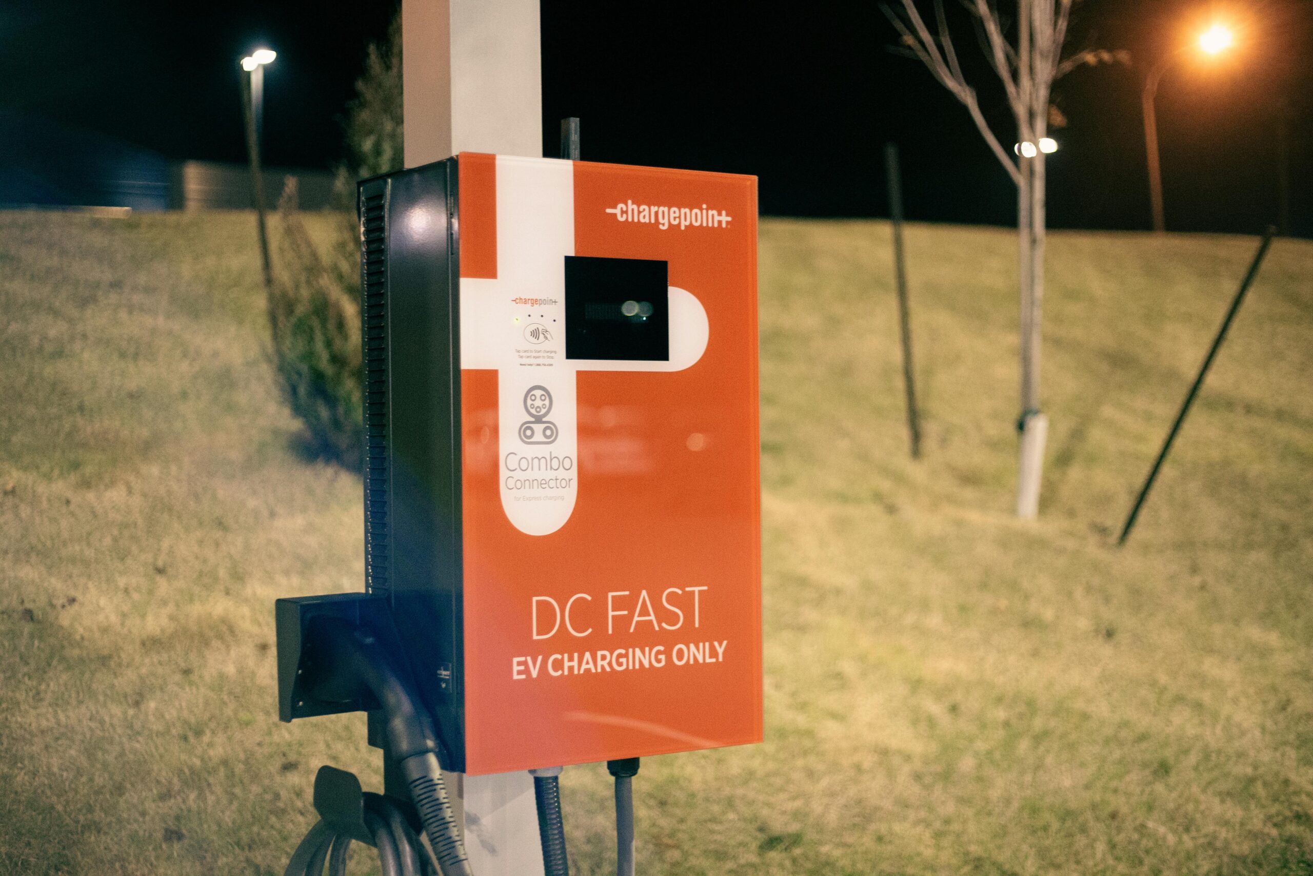
Electric vehicle integration also depends on intelligent data analysis. Charging infrastructure placement requires understanding where EVs travel, park, and need power. Data-driven planning ensures charging stations appear where they’ll see maximum utilization, supporting the transition to zero-emission transportation.
💰 Economic Benefits and Cost Efficiency
While data-driven mobility systems require upfront investment, their economic returns substantially exceed costs through multiple channels. Reduced congestion directly translates to productivity gains as workers spend less time stuck in traffic and goods move more efficiently through cities.
Infrastructure maintenance becomes more cost-effective when guided by data. Rather than repaving roads on arbitrary schedules, cities monitor actual pavement conditions and prioritize repairs where they’re truly needed. This approach extends infrastructure lifespans while reducing unnecessary spending.
Public transit systems achieve better farebox recovery ratios when data guides service planning. By matching supply with demand, agencies transport more passengers with existing resources, improving financial sustainability without raising fares or cutting service.
| Economic Benefit Category | Typical Impact Range | Implementation Timeline |
|---|---|---|
| Congestion reduction savings | 15-30% time savings | 6-18 months |
| Public transit efficiency gains | 10-25% cost reduction | 12-24 months |
| Infrastructure maintenance optimization | 20-35% budget efficiency | 18-36 months |
| Accident cost reduction | 25-40% fewer crashes | 24-48 months |
🔐 Privacy Considerations and Ethical Data Use
The power of data-driven mobility planning raises legitimate privacy concerns that cities must address transparently. Collecting detailed information about how people move through urban spaces creates potential for misuse or unauthorized surveillance.
Responsible implementation requires robust privacy protections built into systems from the beginning, not added as afterthoughts. Data anonymization techniques ensure that individual identities cannot be extracted from aggregated mobility patterns. Strong access controls limit who can view detailed information, while clear retention policies specify how long data remains stored.
Public engagement represents another critical component. Cities implementing data-driven mobility systems must clearly communicate what information they collect, how they use it, and what safeguards protect privacy. Transparency builds the public trust necessary for successful implementation.
Regulatory frameworks continue evolving to balance mobility innovation with privacy protection. Forward-thinking cities proactively establish policies that enable beneficial data uses while preventing invasive surveillance, setting standards that other jurisdictions can follow.
🚀 Emerging Technologies Shaping the Next Generation
Current data-driven mobility applications represent just the beginning. Emerging technologies promise even more transformative capabilities as they mature and integrate into urban transportation systems.
Autonomous Vehicle Integration
Self-driving vehicles generate enormous data volumes while simultaneously requiring detailed environmental information to navigate safely. This creates a symbiotic relationship where autonomous vehicles feed data back into city mobility systems, which in turn provide the intelligence AVs need for optimal routing and coordination.
Fleet management of autonomous taxis and shuttles will rely entirely on data-driven dispatch algorithms that position vehicles where demand will emerge, minimizing wait times while maximizing utilization. These systems could dramatically reduce the total number of vehicles needed in cities while improving mobility access.
Digital Twin Technology
Digital twins—virtual replicas of entire transportation networks—enable cities to test interventions before implementing them physically. Planners can simulate new bus routes, traffic signal timing changes, or infrastructure projects within the digital twin, observing impacts without disrupting real-world operations.
These simulations grow more accurate as they incorporate real-time data, eventually predicting transportation system behavior with remarkable precision. Cities can model years of operations in days, dramatically accelerating innovation cycles and reducing costly mistakes.
5G Connectivity and Edge Computing
Next-generation wireless networks enable near-instantaneous communication between vehicles, infrastructure, and central systems. This ultra-low latency supports safety applications like collision avoidance that require split-second responses impossible with current technology.
Edge computing processes data locally rather than sending everything to distant data centers, reducing delays and bandwidth requirements. Traffic signals equipped with edge computing capabilities can make sophisticated decisions independently while coordinating with neighboring intersections and central systems.
🌍 Global Success Stories and Lessons Learned
Cities worldwide are pioneering data-driven mobility with varying approaches and impressive results. Singapore’s comprehensive smart mobility platform integrates all transportation modes into a single planning and management framework, enabling world-class efficiency despite limited geography. Their system demonstrates how even constrained cities can achieve excellent mobility through intelligent data use.
Barcelona transformed urban mobility by installing extensive sensor networks that monitor everything from traffic flow to air quality. This data infrastructure supports evidence-based decisions about pedestrian zones, bus routes, and cycling facilities. The city reports that data-driven planning helped reduce traffic accidents by 27% over five years while improving average travel speeds.
Los Angeles implemented one of the world’s largest adaptive traffic signal networks, synchronizing over 4,500 intersections through centralized data analysis. The system reduced travel times by 12% while cutting emissions from idling vehicles substantially. This success inspired other North American cities to pursue similar implementations.
Copenhagen’s bicycle planning relies heavily on data from sensors embedded in cycling infrastructure. The city analyzes riding patterns, speeds, and route choices to continuously optimize its world-renowned cycling network. This data-driven approach helped increase bicycle mode share to over 40% of commuter trips.
🎓 Building Capacity: Skills and Institutions for Data-Driven Planning
Successful implementation requires more than technology—cities need professionals who understand both transportation planning and data science. This interdisciplinary expertise remains scarce, creating workforce development challenges for cities pursuing data-driven approaches.
Universities are establishing specialized programs combining urban planning, data analytics, and computer science to prepare the next generation of mobility professionals. These programs emphasize practical skills like data visualization, statistical modeling, and system integration alongside traditional planning knowledge.
Existing transportation professionals require upskilling to remain relevant in data-driven planning environments. Cities and professional organizations offer training programs that help planners, engineers, and managers develop data literacy and analytical capabilities without becoming full-time data scientists.
Institutional restructuring often accompanies technological change. Traditional transportation departments operated in silos separating planning, operations, and maintenance. Data-driven approaches work best when these functions integrate around shared information systems and collaborative workflows.
📈 Measuring Success: Performance Indicators for Smart Mobility
Data-driven planning enables sophisticated performance measurement far beyond simple metrics like traffic counts. Cities can track comprehensive indicators that reveal how well transportation systems serve diverse community needs and strategic objectives.
Traditional metrics like average travel speed remain relevant but gain context from complementary measures. Travel time reliability—the consistency of journey durations—often matters more to users than absolute speed. Data systems measure this precisely, identifying unreliable corridors for improvement.
Equity indicators reveal whether mobility improvements benefit all communities or concentrate advantages in privileged areas. By analyzing access to opportunities like jobs, healthcare, and education across different neighborhoods, cities ensure that data-driven planning promotes social justice rather than reinforcing existing disparities.
Environmental performance tracking measures actual emissions reductions, air quality improvements, and progress toward sustainability goals. Continuous monitoring holds cities accountable for environmental commitments while identifying strategies that deliver the greatest ecological benefits.
🔮 The Road Ahead: Continuous Innovation and Adaptation
Data-driven urban mobility planning represents a fundamental shift toward continuous improvement rather than periodic interventions. Traditional planning produced static solutions that remained unchanged for years or decades. Data-driven approaches enable constant refinement as systems learn from ongoing experience and adapt to changing conditions.
This evolution requires cultural changes within transportation agencies accustomed to stability and long planning horizons. Embracing experimentation, accepting that some initiatives will underperform, and remaining flexible enough to adjust course quickly represent essential mindset shifts for organizations implementing data-driven approaches.
The integration of mobility planning with broader smart city initiatives amplifies benefits. Transportation systems don’t exist in isolation—they connect with housing, economic development, environmental management, and social services. Comprehensive data platforms that span these domains enable holistic urban planning that addresses challenges systematically rather than in fragments.
Citizens increasingly expect the same responsiveness from public services that they experience from commercial platforms. Data-driven mobility planning helps transportation agencies meet these expectations, providing reliable, personalized experiences that rival private alternatives while serving broader public purposes.
The transformation of urban transportation through data-driven planning continues accelerating as technologies mature, costs decline, and successful implementations demonstrate value. Cities embracing this revolution position themselves for sustainable prosperity, creating transportation systems that serve everyone safely, efficiently, and equitably. The future of urban mobility isn’t just smarter—it’s fundamentally better, and that future is already arriving in forward-thinking cities worldwide.